BP - Maps and plans
Maps and plans related to the shale oil industry
| Image | Code | Title | Description | |
|---|---|---|---|---|
|
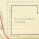
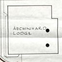
143300 | Plan entitled ''Auchenhard Lodge'' | File Record | Plan entitled 'Auchenhard Lodge - Plan referred to'. Dated 3rd february 1958. Showing outline plan of Lochinard Lodge, with draind and water supply. marked. Scale … |
|
143913 | Minute of Agreement between The Pumpherston Estates Limited and The Pumpherston Oil Company Limited. | File Record | Minute of Agreement between The Pumpherston Estates Limited and The Pumpherston Oil Company Limited. With reference to construction of Dam across Linnhouse Water and wayleave … |
|
183306 | Plan of Auchenhard Lodge. Dated 3rd February 1958. | File Record | Plan of Auchenhard Lodge with boundary line highlighted in red. Dated 3rd February 1958. Scale: 1"=10'-0" |
|
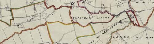
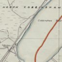
217037a | Plan of Mineral Leases in the Tarbrax area | File Record | Plan showing boundaries of mineral leases in Tarbrax area - 1950's ? |
|
|
217037b | Plan of Mineral Leases in the West Calder area | File Record | Boundaries on mineral leases in the West Calder area plotted on a 6" map. Dated 24th May 1960 |