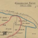
Glendevon Farm
code: 195701
Collection code:
195701
Collection:
Description
Map entitled Glendevon Farm, but marked up in December 1940 to show Glendevon, Trinlaymire, Kirklands, Waterstone and Hillend Farms along with Broxburn Shales Stooped and Broxburn Upper Shales Stooped. Scale 6"=1mile
None