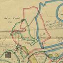
Map showing Shale Workings
code: 195703
Collection code:
195703
Collection:
Description
Map marked up to show Shale Workings, Broxburn in stoops and stooped; Dunnet, stooped; Camps, stooped; Pumpherston, stooped. Also shows resumed land and farms named: Duddingston and Newton, Tottlywells, Duntarvie and Westfield-Dundas. Dated December 1940. Scale: 6"=1mile
None