Plans
Maps, plans, architectural and technical drawings
| Image | Code | Title | Type | Description |
|---|---|---|---|---|
|
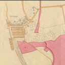
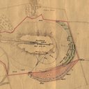
LVSAV1984.003 | Plan - damaged ground on the Hopetoun Estate 1932 | File Record | Oakbank Oil Company Ltd coloured plan showing damaged ground on the Hopetoun Estate. |
|
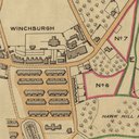
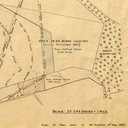
LVSAV1984.004 | Plan - Niddry Mains Farm, 1941 | File Record | Oakbank Oil Company Ltd coloured linen plan of Niddry Mains Farm, Hopetoun Estate. |
|
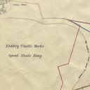
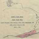
LVSAV1984.005 | Plan - Niddry Castle Works spent shale bing, 1939. | File Record | Coloured plan of Niddry Castle Works spent shale bing showing extensions from 1904-1932. |
|
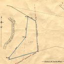
LVSAV1984.006 | Plan - Niddry Castle bing, 1922 | File Record | 25" = 1 mile plan Niddry Castle bing , dated June 1922. |
|
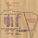
LVSAV1984.007 | Plan - spent shale bing at Niddry Castle, 1957 | File Record | Plan of Niddry Castle works, spent shale bing with note on ground leased at various dates |
|
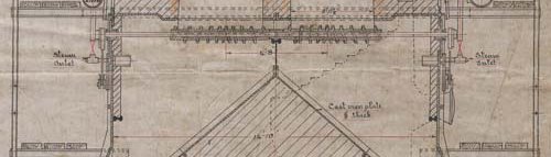
LVSAV1984.008 | Plan - electricity supply lines at Niddry Castle bing, 1944 | File Record | 25" plan showing the layout of electricity supply lines |
|
LVSAV1984.009 | Plan - ground leased at Niddry Castle bing, 1951 | File Record | 1/2500 plan of Niddry Castle bing, notes on ground leased at various dates. Dated 05/03/1951. |

|
LVSAV1984.010 | Plan - Niddry Castle bing, with overhead power line, 1943 | File Record | 25" = 1 mile plan of Niddry Castle bing showing the overhead power line |
|
LVSAV1984.011 | Plan - power line at Niddry Castle 1954 | File Record | 1/2500 plan Niddry Castle bing showing altered route of power line covering dates from 1951 to 1954 |

|
LVSAV1984.012 | Plan - Niddry Castle bing, 1923 | File Record | Blueprint plan of Niddry Castle bing showing ground gained from 1904-1923 |