Recent
| Image | Code | Title | Type | Description |
|---|---|---|---|---|

|
P1020073 | Blackburnhall | File Record | Blackburnhall farm, 24/04/2021 |
|
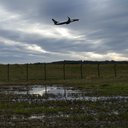
P1050300 | Ingliston | File Record | Aircraft taking off close to the site of Ingliston No.36 & 37 pit |
|
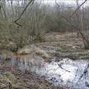
P1050316 | Hallyards | File Record | Areas of subsidence in Hallyards wood |
|
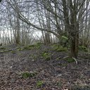
P1050324 | Hallyards | File Record | Site of Hallyards Castle |
|
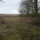
P1050330 | Hallyards | File Record | Course of mineral railway where it crossed the road from Hallyards to Wester Ingliston |
|
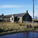
P1050719 | View of Woodmuir colliery | File Record | general view of Woodmuir colliery |
|
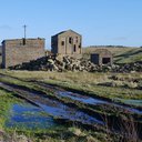
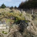
P1050725 | Woodmuir farm | File Record | Derelict housing at Woodmuir farm |
|
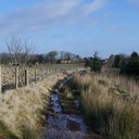
P1050830 | Route of railway at Woodmuir | File Record | Route of railway to Woodmuir pits and quarry |
|
P1050849 | Linn bridge | File Record | Linn bridge on A705 viewed from near woodmuir quarry |
|
P1050886 | Covered reservoir near Woodmuir | File Record | Covered reservoir near Woodmuir |