Map - OS Linlithgowshire
code: LVSAV1991.044
Description
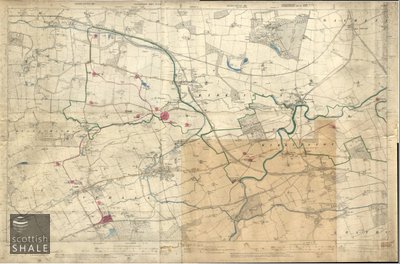
OS Linlithgowshire composite sheet 25" to 1 mile, 1922,(Blackburn to West Calder) with geological features and areas of worked and unworked shale marked in colour. On linen.
Shows Burngrange Pit, Polbeth No 26 Mine, Addiewell Chemical Works, Westwood Pit, Breich No 1 & 2 Pit, Alderstone No 43 Mine, Deans No 4 Pit, Deans No 5, 6, 7 Mines, Seafield Crude Oil Works, Deans Crude Oil Works, Pumpherston Oil Works, Pumpherston No 4 Mine.
Thought to have originated from Scottish Oils Ltd.