From Geological Survey, Scotland, Oilshales of the Lothians, third edition 1927
Polbeth Field
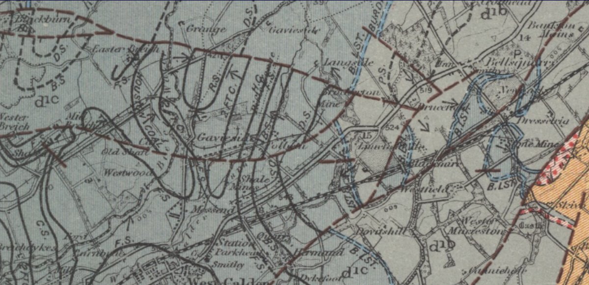
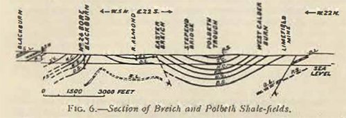
The Polbeth Shale-field is an easterly continuation of the Breich area. The strata lie in a deep basin, which is an extension of that found to the north of West Calder and which is separated from the latter by the Mid-Breich-Brotherton Fault. The lowest beds exposed on the east side of this fold immediately underlie the Dunnet Shale, while in the centre of the trough strata above the Raebum Shale are reached. In the Harwood Water, north of the Brotherton Fault, there is a good section of the beds beneath the Dunnet Shale, consisting of green sandy blaes with green and grey sandstones. The Shale has been mined by Young's Oil Company, the workings extending to the bottom of the trough, where they are at a vertical depth of 250 fms. from the surface, this being the deepest mine in the Scottish shale-fields. Since the bottom of these workings terminates against the Langside-Blackburn Fault, which is known to have a downthrow south of 200 fms., they should be brought by this displacement against the Pumpherston Shales. The fault is again seen by the stream south of Langside, where there is an excellent section of the Under Dunnet Shale, 6 ft. thick. In the floor or the seam occurs an inch of volcanic ash (Barracks Ash), and below are sandstones, the limy entomostracan top or which represents the Barracks Limestone position.
The Langside-Blackburn Fault, which marks the northern boundary of the field, has been proved in the Dunnet workings south and west of Langside ; the Two-foot Coal is seen nearly vertical. where this fault crosses the Breich Water, south of Grange Gavieside Field On the north side of the Langside-Blackburn Fault, between Gavieside and the River Almond. there is a broad basin containing the Dunnet Shales. This trough is a northerly continuation of that at Polbeth and the Langside Fault has a displacement at this point of 200 fms. At the Gavieside mine the Main Dunnet varies from 6 to 16 ft , but its general working thickness is 10 ft.
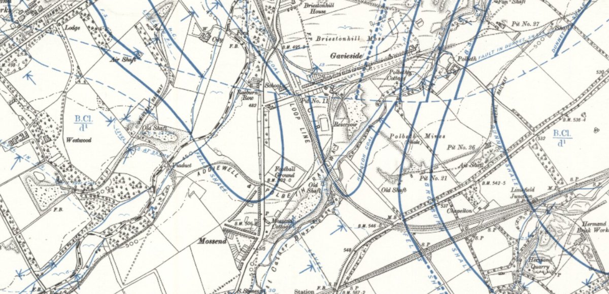
Gavieside Field
At the north end of the Gavieside syncline, several outcrops of dolerite are seen in the River Almond between the weir and the ford west of Livingston, where the Lower or Under Dunnet Shale (6 ft.) is seen by the stream, with the Barracks Ash and Limestone (at least 1 ft.) below, while the Main Dunnet seam was proved several years ago by trial pits. To the east of this weir marly strata, together with conglomerate bands and limy ribs of sandstone, are exposed along the north bank of the stream.